


A Trip to "Back in the Day"
The Waterfront of Red Hook, Brooklyn

Ask me where I’m from, I proudly say Red Hook, Brooklyn! I have to add “Brooklyn” or it can be confused with Red Hook, Duchess County, NY. The history of my Red Hook is rich. For more about it, check here. It would be too long to get into in this article.
I’m from The Red Hook Projects! For quite a few years, when non Red Hook residents spoke of it, they’re usually referencing the waterfront area & docks. What we used to call “the back.” If you lived in another NYCHA Projects and said “Red Hook,” you most likely were talking about Red Hook Houses (aka Projects). Okay, history lesson done!
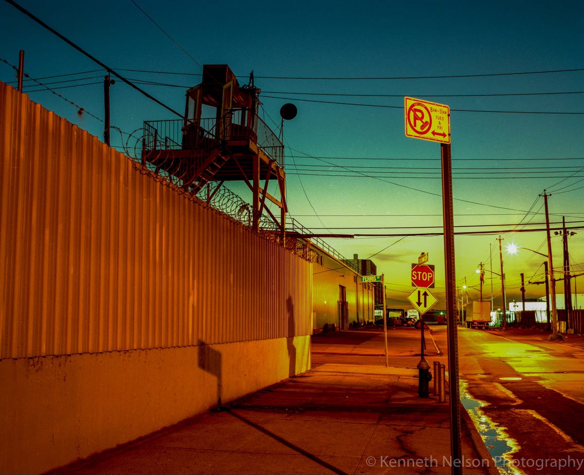
Photo: September 2003
Oh, the memories that come flying back when I view these photographs. This part of the neighborhood is, and always was industrially occupied. There’s not many residential buildings this “far back” near the waterfront. Upper New York Bay—just one block up ahead. It’s where the Hudson & East Rivers converge. The best place on land to view the Statue of Liberty anywhere in New York, or New Jersey (unless you wanted to see her back). Sadly, I’ve lost all the photos I’ve taken of it from that vantage point. I admit to being a careless photo cataloger back then.
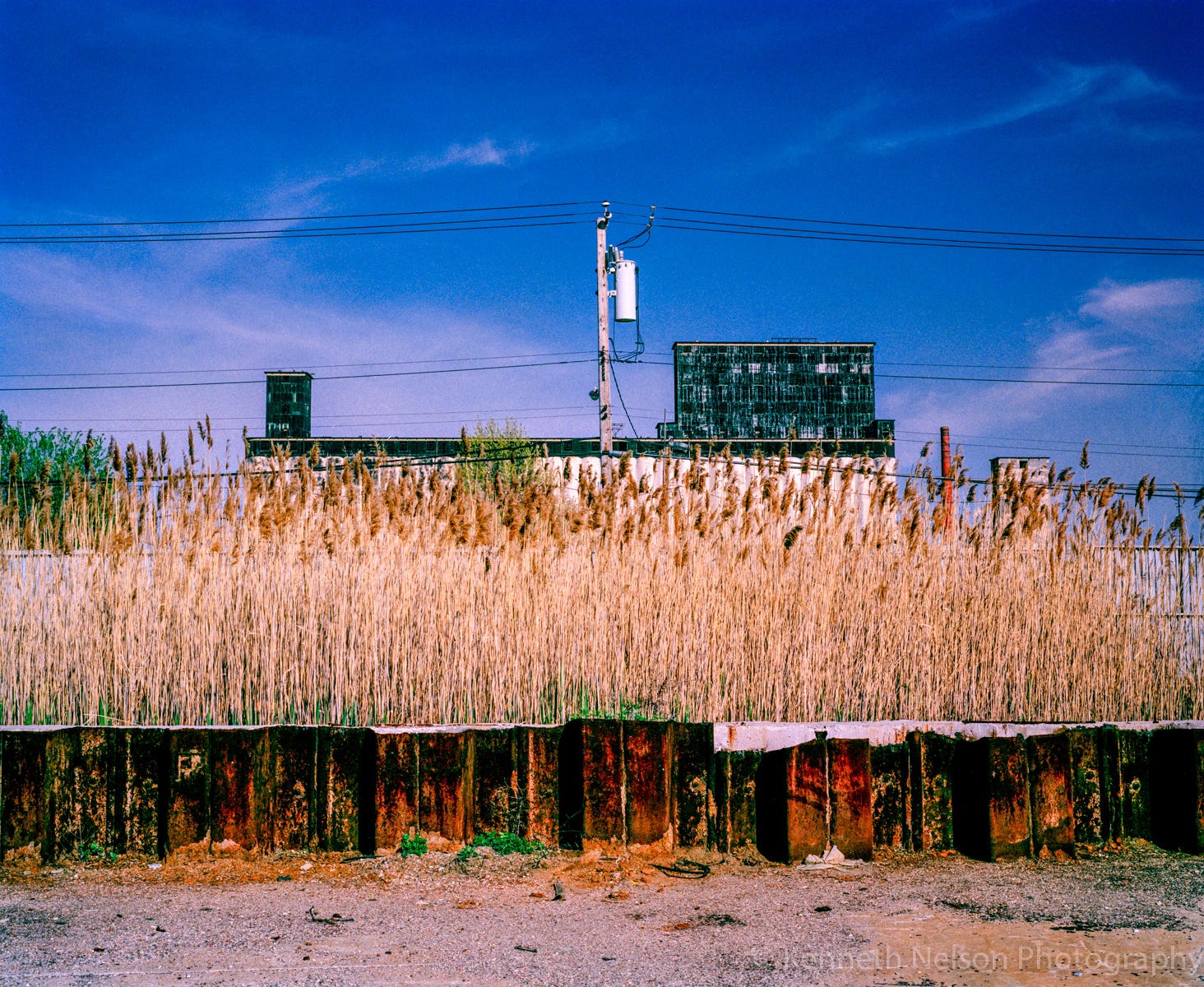
Photo: May 2003
If you haven’t read my previous article on the Grain Terminal, I hope you’ll give it a read to understand my thought about the building. It’s accessible to the Henry Street Basin, which shares the same waterway as the Gowanus Canal in Upper New York Bay. Yes, that Gowanus Canal!
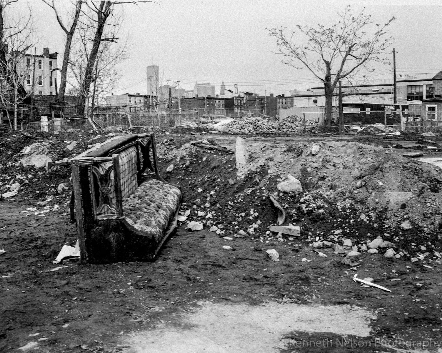
Photo: February 1987
This photograph offers quite a viewpoint into what Red Hook looked like in the 70s-80s. Public School 15 is the two-story building on the right. At this point in time, it’s been open for about eleven years. I don’t recall what occupied these vacant lots in the foreground, though I tend to remember a series of fires destroyed the area. If you’d like to see what it looks like now, click here. All this within view of Lower Manhattan's World Trade Center.
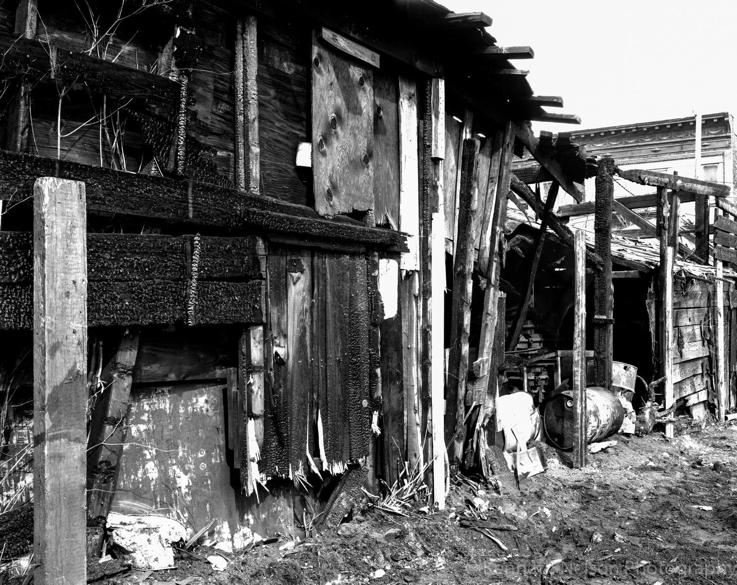
Photo: February 1987
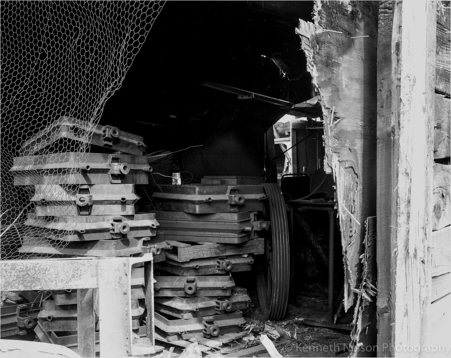
Photo: February 1987
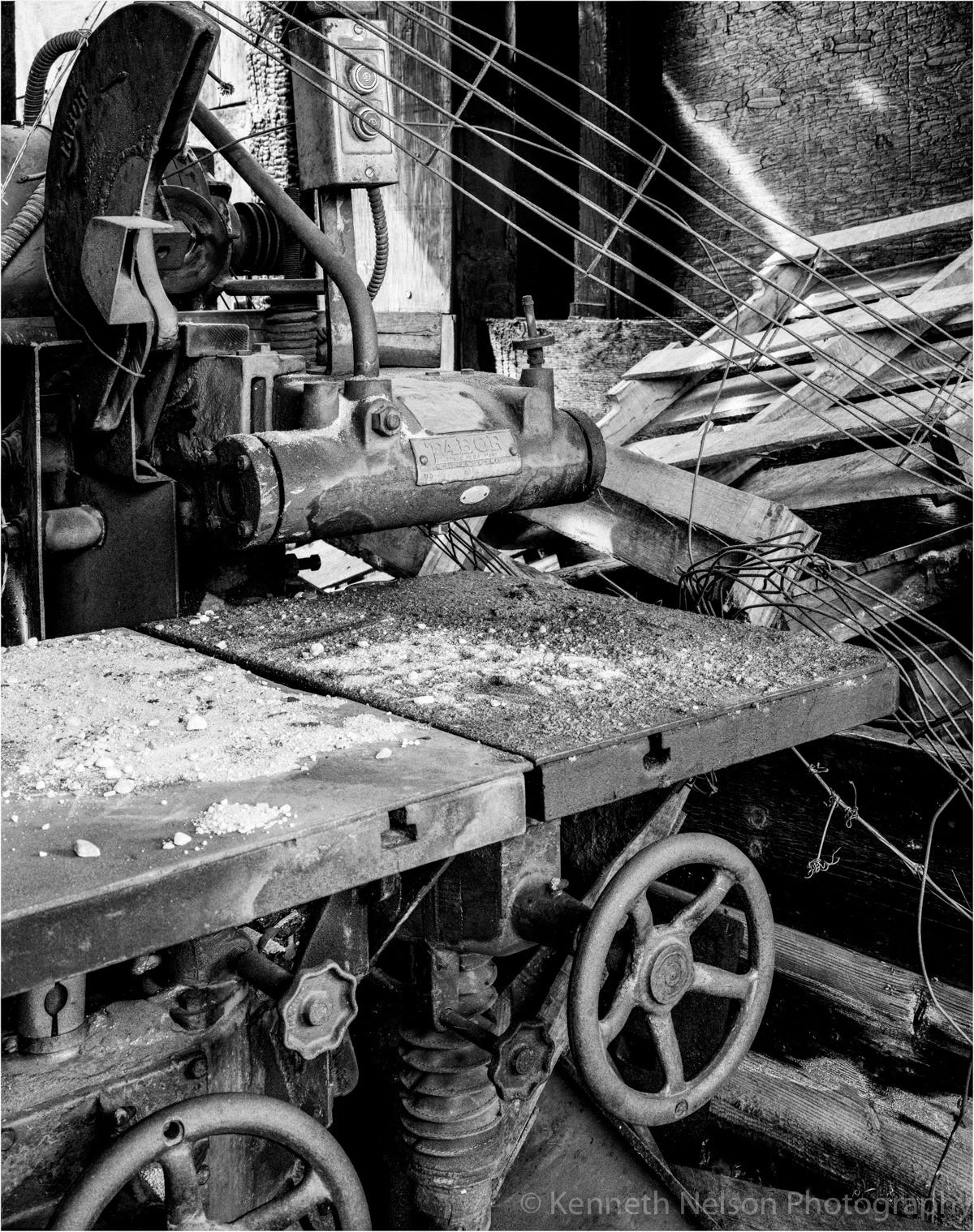
Photo: February 1987
In the three photographs above, there is nothing to block access to the interiors of these industrial structures. They were within two blocks of Public School 15.
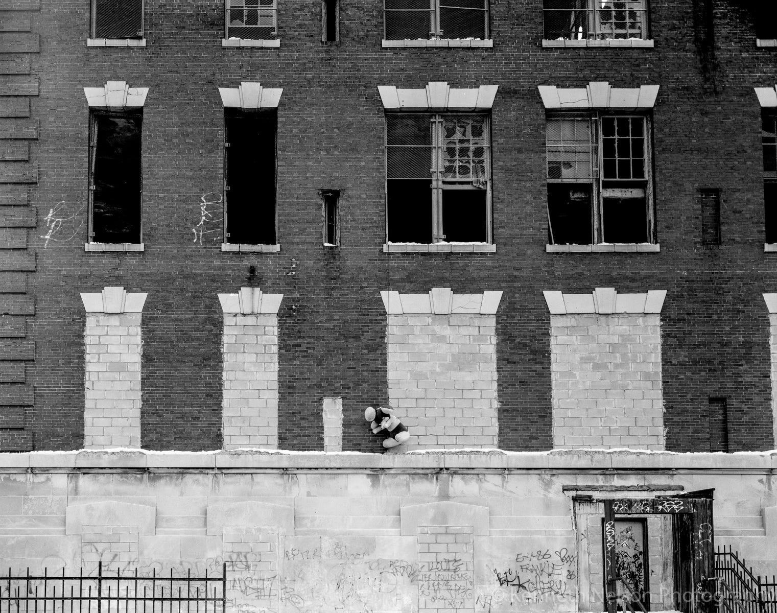
Photo: February 1987
Public School 30 as shown in the above photograph had been closed for more than a decade by this point. Student were moved to two other local elementary schools in the area, Public School 15 (a modern building) & Public School 27. A further sign that Red Hook’s waterfront was suffering.
The downturn of Red Hook’s waterfront reversed in the early 2000s with rezoning of surrounding neighborhoods. The revitalized (gentrified) neighborhoods along the Queens/Brooklyn waterfront—from Astoria through Red Hook, to Sunset Park and beyond.
Although P.S. 15 & P.S. 30 were just one block from each other, that one block was dramatic in how the buildings were utilized or underutilized over the years.
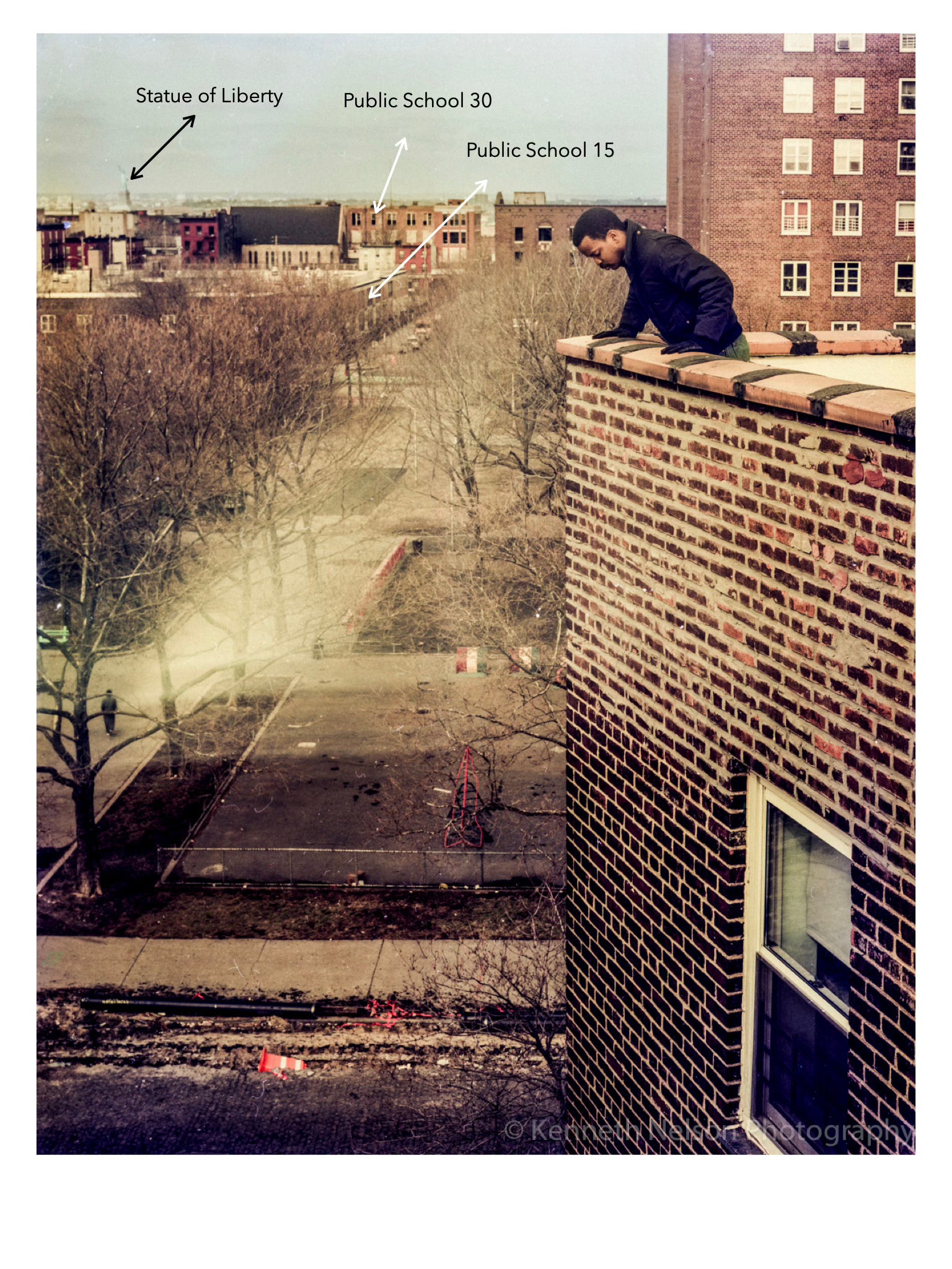
Photo: February 1988
So! About the Statue of Liberty… The first neighborhood in view of the face of the Statue of Liberty is Red Hook! When I was younger, I was able to look out the windows of my family’s apartment and see it’s face looking right at us. The uniqueness of that experience dwindled as I got older and time wore on because it was our everyday life.
The Map below shows the layout of Upper NY Bay and Red Hook’s relation to it.
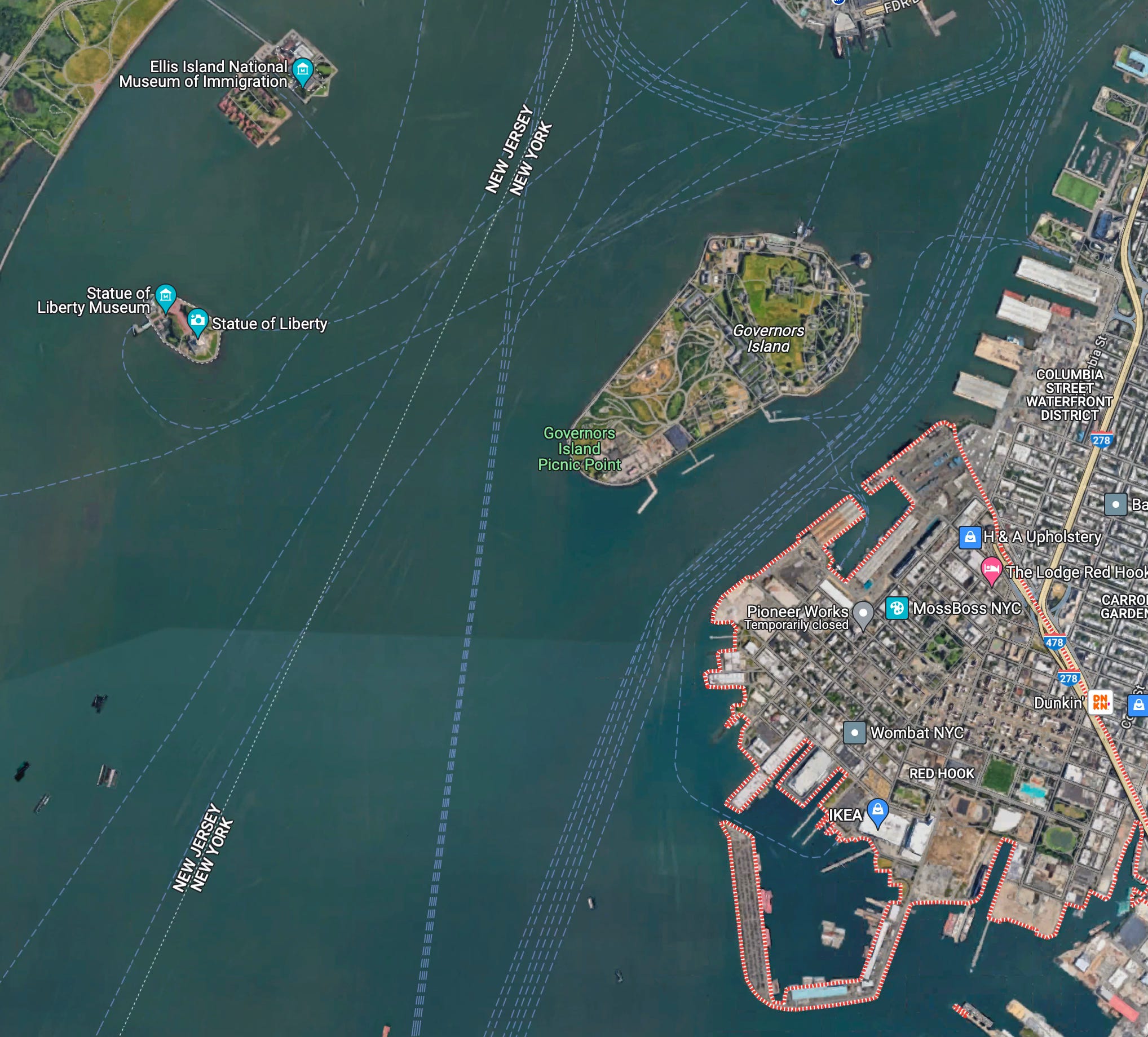
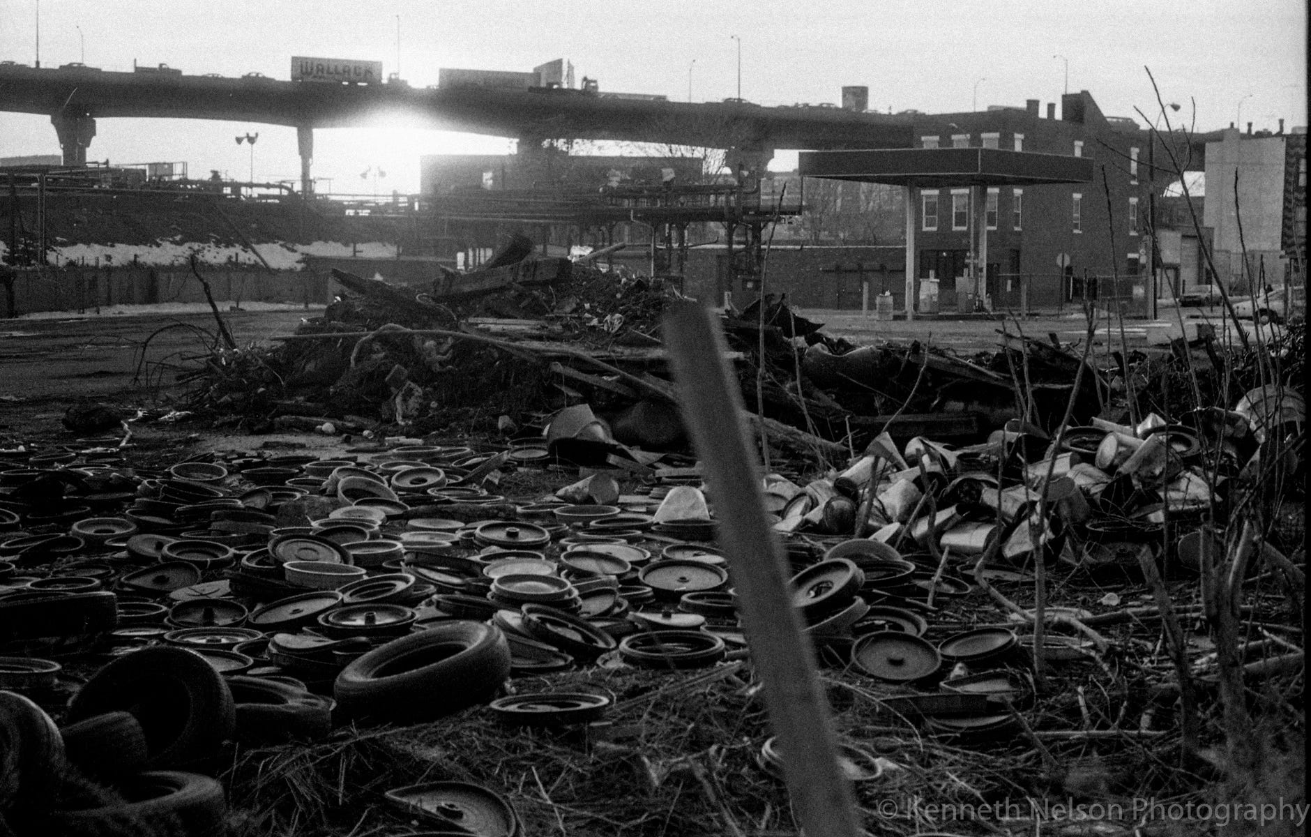
Photo: February 1987
I’ll divert here for a quick moment. This photo is taken in the Gowanus neighborhood. Many may think it to be Red Hook, but it’s not. The infamous Gowanus Canal is but fifty yards left (←) of camera position. The photogenic Smith-9th Street elevated subway station is behind camera on right . One of the highest elevated subway station in the world. While in front, a graveyard for hub caps-next to a gas station-next to a heating oil refilling and distribution station.
In the distance, the Gowanus Expressway as it leads into the Brooklyn Queens Expressway a mile or so to the right. The Gowanus Expressway travels over Hamilton Avenue in this area—it is the dividing line between Red Hook and Gowanus.
There’s so much more to the neighborhood than I can get to in a short article. As mentioned earlier, community members have worked to reshape Red Hook’s future. This view is just a reflection of what I remember it being in my earlier years there. Super Storm Sandy’s effect was severe and drastic. I’ll leave it here for now.
Thank you for reading this far, I appreciate your indulgence in doing so. If you enjoyed the article, supporting with a donation or subscription would go a long way in making sure articles like this can continue.
Till next time….
Kenneth
Great article! I love taking a trip down memory lane through your articles and photos.
Why not consider a monthly photo in the local paper. I'm the publisher, George Fiala. my email is gbrook8344@gmail.com It could be a photo with a short description, entitled "Way Back When" or something like that.